


Home Services Topographic Surveying

Topographic Surveying

Oilix

Xglobe Exploration Limited provides professional Topographic Surveying services across Zambia, delivering precise land surveys, terrain mapping, and geospatial data for mining, mineral exploration, infrastructure, engineering, and construction projects. Using advanced surveying technologies, drone mapping, DGPS, and modern measurement techniques, we produce accurate topographic information that supports efficient planning, design, and project execution.

Our experienced surveyors deliver detailed topographic maps, contour surveys, digital terrain models (DTMs), elevation data, boundary surveys, and site measurements to support informed decision-making and regulatory compliance. While our primary focus is Zambia, we also provide specialist topographic surveying and geospatial support for selected projects across East Africa and Southern Africa.

Key Benefits

Precision Topographic Surveying for Successful Project Development

Our topographic surveying services provide accurate land measurements, terrain analysis, and spatial data that support informed decision-making for mining, engineering, construction, infrastructure, and land development projects. Using advanced surveying technologies, we deliver reliable information that improves planning, design accuracy, and project execution.

By combining experienced survey professionals with modern GPS, Total Station, drone mapping, and GIS technologies, we help clients minimize project risks, optimize site development, and ensure efficient resource management across West Africa.

High-precision topographic surveys using drone technology to generate Digital Terrain Models (DTMs) and orthophoto maps.

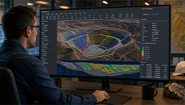
Advanced surveying software and data processing systems for managing large drone survey datasets efficiently.

DGPS surveys for drill collar positioning, trench profiling, and accurate exploration site mapping.

Establishment of Ground Control Points (GCPs) to improve the accuracy of aerial and drone surveying projects.

Surveying of adits, shafts, and historical underground mine workings for exploration and rehabilitation projects.

Audit, verification, and transformation of historical survey data into modern coordinate reference systems.

Professional GIS integration, mapping support, and spatial data management for surveying projects.

Accurate in-pit volume calculations and stockpile measurements using drone survey technology.

Installation of survey control beacons and permanent survey control networks for exploration and mining projects.

Transformation of local grid coordinates into UTM coordinate systems for standardized spatial data management.

Monthly production volume surveys for mining companies, contractors, and large-scale earthworks projects.

Land use mapping, compensation surveys, and property boundary assessments supporting infrastructure and development projects.

Resolution of mineral licence boundary disputes through accurate cadastral surveying and geospatial verification.

4.9

Trusted Topographic Surveying Partner for Mining, Engineering & Infrastructure Projects

Frequently Asked Questions

Common Questions About Our Topographic Surveying Services

Find answers to frequently asked questions about our topographic surveying services, including land surveys, contour mapping, GPS surveys, drone mapping, digital terrain modelling, and engineering surveys for mining, infrastructure, and development projects across West Africa.

We provide comprehensive topographic surveying services including land surveys, contour mapping, GPS surveys, Total Station surveys, drone mapping, digital terrain modelling, elevation surveys, site layout surveys, and engineering surveys for mining, infrastructure, construction, and land development projects.

Topographic surveys provide accurate information about land features, elevations, contours, natural and man-made structures, enabling engineers and project managers to design, plan, and execute projects with greater precision while minimizing construction risks.

Our surveying services support mining companies, engineering consultants, construction firms, infrastructure developers, government agencies, land developers, utility providers, and environmental organizations throughout West Africa.

We utilize modern GPS systems, Total Stations, UAV drone mapping, GIS software, digital levels, and advanced surveying equipment to deliver highly accurate topographic data and professional survey reports.

Yes. We provide customized surveying solutions tailored to mining operations, engineering developments, transportation projects, industrial facilities, and infrastructure developments, ensuring accurate data collection that meets project-specific requirements.

Xglobe Exploration Limited combines experienced surveyors, advanced surveying technologies, precise data collection, GIS expertise, and comprehensive reporting to deliver reliable topographic surveying solutions that support successful mining, engineering, construction, and infrastructure projects across West Africa.